
In 2019, Syria and Iraq saw a spike in vegetation fires, a pattern not seen in neighbouring countries during the same year. During this year 4.8% of Syria’s total land area burned. This is not only a spatial anomaly (compared to neighbouring regions with similar climates), but also a temporal anomaly, as it is a 2300% increase relative to the average fire activity in Syria (Zubkova, 2021). Wan Ni Lin also found that 3.5%, compared to the average <1%, of Iraq’s total land area burned during this year (paper to come).
Global fire data, such as the MODIS Thermal Anomalies and MODIS Burned Area products, are coarse and can miss important details on the pattern and behaviour of fires. For areas like Australia, North America, and Europe, high-resolution data specifically produced for the respective region exists (see CSIRO, NASA, and Copernicus), but this is not the case for many other areas around the globe. For a conflict-stricken, arid and understudied region with limited data availability, like large areas of the Middle East, this gives rise to both scientific opportunities and challenges.
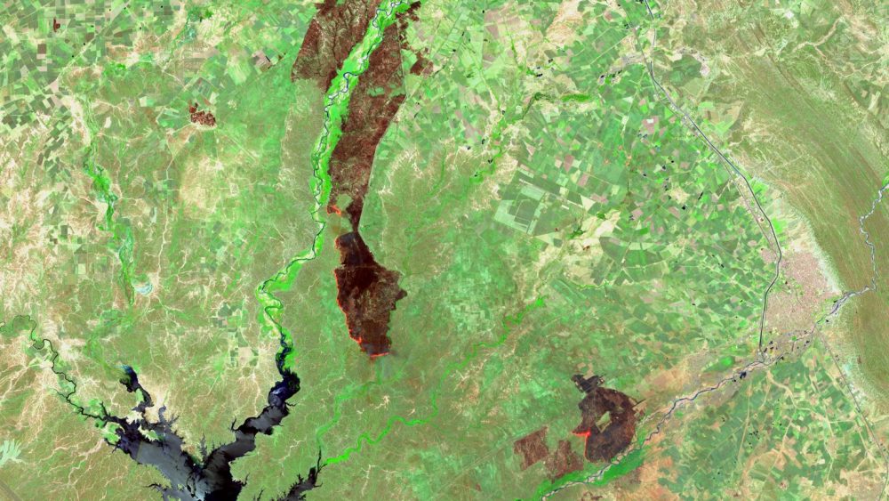
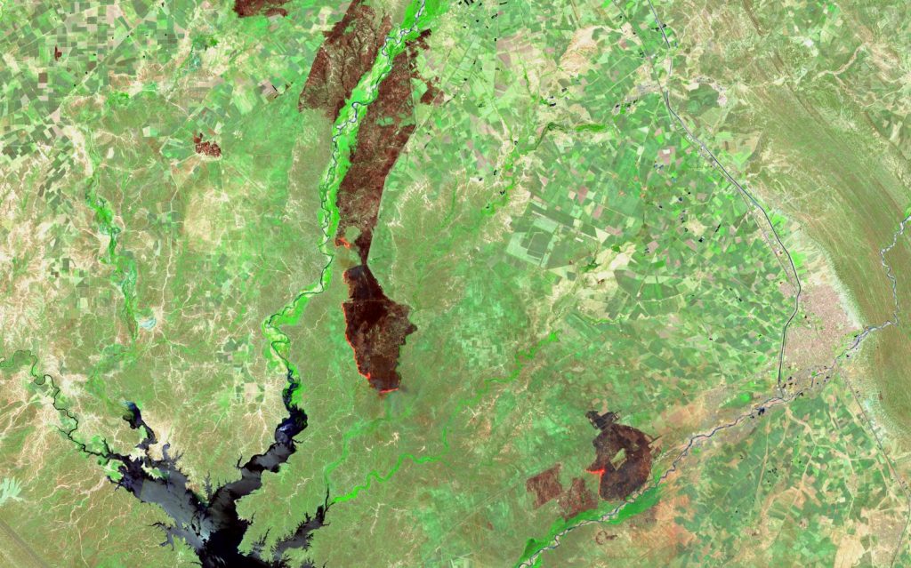
In late 2025, we organized a mapathon focusing on this issue, aiming to map active fires and burn scars in a 1 000km² (100 000ha) area covering parts of Syria, Iraq and Turkey. This is our second mapathon, made possible with the help of SWECO, as we used their workspace (and WiFi) in Malmö, and SamGIS, who graciously paid for our pizzas. The participants of the event managed to classify approx. 40 active fires and nearly 500 burn scars using Sentinel-2 imagery – something we definitely consider a success. Examples of what an image used in the mapathon can look like, can be seen below.
The collected data will contribute to a more efficient way for us to map fire regimes, hotspots (areas with high frequency or intensity of fires) and anomalies in the entire Middle East. The collected data will be the basis of mapping these fires and scars using a machine learning approach, which in turn can help us understand how spatiotemporal patterns of vegetation fires relate to geopolitical contexts (e.g. armed conflict).
The event is also significant as it contributes both to freely available data on a pressing topic and a data-limited region, and as it introduces remote sensing (satellite imagery) and geospatial-focused methods to a greater group of people. Geographers or geo-specialist which have previously not worked with fires, the Middle East, or neither. We are grateful for the contributions and happy that so many want to contribute to important research!


The research related to this event is a part of the project Pyrogeography in Conflict Contexts: Satellite Remote Sensing of Vegetation Fires in the Middle East. The scientific output of this event will be posted later on, but you can read more about the event in this QnA with Lina Eklund. To read more about data availability in the Middle East, see our blog post on weather stations in the Middle East, by Lovisa Rosenquist Ohlsson.