
Within the physical geography and earth observation communities, land-cover mapping is widely recognized as a foundation for understanding ecosystem function, environmental stability, and human–environment interactions. High-quality land-cover information helps us understand the land and water management, environmental risk, biodiversity health and prepare conservation strategies and is increasingly used to track progress toward the Sustainable Development Goals. In conflict-affected and data-deficient regions, where field access is limited or impossible, satellite-based land-cover mapping becomes even more critical for assessing environmental degradation, displacement impacts, and long-term recovery options (Saah et al., 2019).
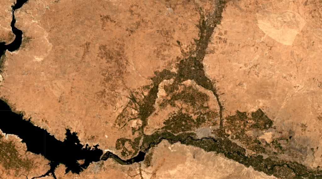
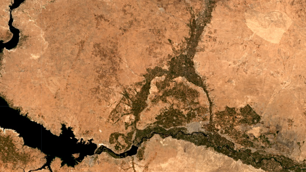
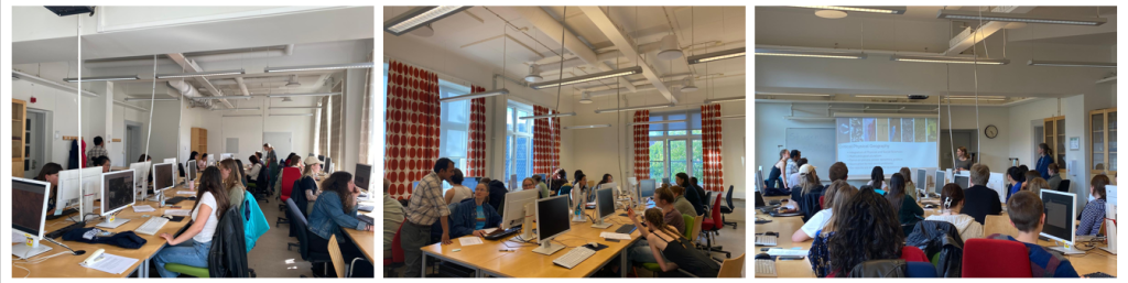
With this background in mind, the Landscape Detectives team organized the Syria Land Cover Mapathon on 7 May 2025, focusing on Syria as a conflict-affected, data-scarce landscape. The event invited participants from Lund University (Bachelor and Master Students) to look beyond single time imagery and instead interpret land cover through both historical and recent satellite data, tracing how agricultural fields have gone fallow over time, how open landscapes have been fragmented by oil extraction ponds, and how forests have been cleared and converted into other land uses. Using open-source tools such as QGIS and Google Earth Pro, volunteers acted as citizen scientists, turned raw satellite imagery into actionable, open training data that can support future research work on Syria’s landscapes.
What makes this Mapathon particularly innovative is its focus on land-cover classes that explicitly capture the socio-political effects of conflict. Rather than relying on generic global categories, the team worked with tailored classes such as “Refugee Camp Areas” and “Abandoned Farmland,” which are rarely represented in standard global products. These more nuanced classes help illuminate not only where landscapes have changed, but also point toward why they have changed, creating an empirical entry point to study the links between armed conflict, displacement, and ecological degradation.
The target of the mapathon was to map the entire Syria in 14 different landcover classes and the participants have managed to label approximately 1600 data points which will serve as an immensely important training and validation dataset for the community of people trying to understand the Syrian landcover.
The work of this Mapathon is not an isolated initiative, but forms a core building block within the broader ECO-Syria project at Lund University: Exploring Conflict–Environment Interactions for Sustainable Development and Conservation. ECO-Syria emphasizes the intertwined nature of ecological health, social justice, and democratic governance, and highlights how information gaps about land-cover change can undermine both environmental management and peacebuilding efforts.
By generating precise, high-resolution land-cover data for a region where ground-based surveys are constrained by insecurity, the Mapathon directly addresses this information gap. The training data produced through the event has already supported the development of a publicly accessible 10 m resolution land-cover map for Syria under the ECO-Syria umbrella, providing an empirical foundation for analyzing ecosystem condition, land degradation, and livelihood pressures across the country. The scientific outputs linked to this work, including detailed documentation and methodological articles, will be shared in due course, and the full training dataset will be openly available on Zenodo so that others can build upon, test, and refine land-cover models for Syria and beyond. You can reach us by contacting Lina Eklund and Purnendu Sardar for any queries.